Back
hike
Back
hike
Loza walking tour
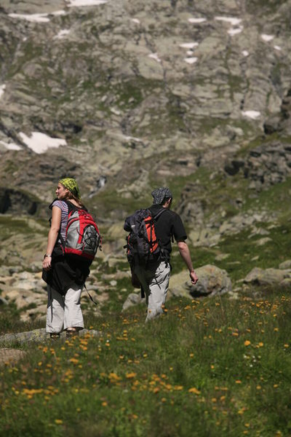
This hike is full of contrasts, skilfully leading you from a wooded atmosphere to high-altitude alpine meadows and pastures. The south-facing slope is perfect for off-season hikes that demand a certain amount of sunshine.
Description
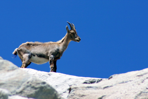
Ready to cross the 1,000-metre threshold in elevation gain? Have you ever heard Scots pine cones popping under the sun's rays? It's a sound you're bound to hear on this long, sustained ascent through the fragrant pine forest towards the Mont at 1,770 metres of altitude. You may also catch a glimpse of snow heather, a rare and protected plant, dressed in beautiful shades of pink. It's such an early bloomer that its petals somehow manage to burst through the last snows. The open clearing now gives way to another ascent - the hike's last challenging climb. Bursting with pride, you enter Vanoise National Park. The slope grows gentler as you reach Croix de la Loza. Take a seat at this observation post. Before you rise the peaks of Bramanais and Mont Cenis, sometimes wrapped in clouds blown by the Lombarde wind. Take care as you descend into the Bonne Nuit valley. From its impressive altitude of 3,695 metres, Dent Parrachée and its sharp ridges command respect. Imagine the spectacular avalanches that sometimes cascade down Sollières in winter! As you go down, make sure you take plenty of refreshing breaks and tie up your laces properly.
Additional welcome
The duration of hiking trails is calculated using reference paces: 300 m/h ascent, 500 m/h descent and 4 km/h on the flat.
As hazards may occur at any time on the routes, the GPX tracks provided are not contractual. They are given for information only. Riders use them at their own risk, depending on their level of technological proficiency and their understanding of the terrain.
-
Minimum age: 12
Environments
-
 Forest location
-
Mountain view
-
Mountain location
-
Close to a public transportation
-
Bus stop < 500 m
-
Pond within 5 km
-
In a nature reserve
Rates
Free access.
Itinerary
-
 Distance
11.6km
Distance
11.6km
-
 Route type
LOOP
Route type
LOOP
-
 Elevation gain
1100m
Elevation gain
1100m
-
 Negative gradient
1100m
Negative gradient
1100m
-
 Daily duration
04h00
Daily duration
04h00
-
 Signposted itinerary
Yes
Signposted itinerary
Yes
-
 Beaconing accuracy
Mixed signposting (PR, PNV and GR)
Beaconing accuracy
Mixed signposting (PR, PNV and GR)
-
 Nature of the land
Stone,
Ground,
Grit,
Not suitable for strollers
Nature of the land
Stone,
Ground,
Grit,
Not suitable for strollers
-
 Maximum altitude
2357m
Maximum altitude
2357m
Opening period
From 01/06 to 15/10 daily.
Subject to favorable snow and weather conditions.
Additional opening
-
Subject to favorable weather
-
Subject to snow conditions
Location
Departure from the village along the RD83.
By bus: Line S52 - Mairie stop, Line S53 - Les Favières stop.
By car: park near the Val Cenis Sollières church/mayor's office.
Documents

Animals
Pets allowed : No
Pets are not allowed on this hike in the Vanoise National Park.
Guidebook with maps/step-by-step
-
To guide you in the field, consult the "step-by-step" directional diagram provided in pdf.


-
Distance
11.6km
-
Daily duration
04h00
-
Elevation gain
1100m
-
Negative gradient
1100m