Back
hike
Back
hike
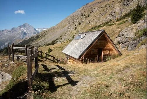
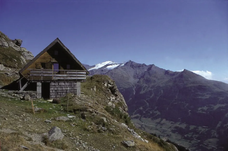
Hiking to the Cuchet refuge
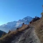
Cross an enchanting forest to reach a rocky promontory. Enjoy spectacular views as you journey through a wide range of mountain landscapes. Stop dilly-dallying! A breathtaking panoramic view awaits you up there...
Description
Marmots' calls greet you as soon as you leave the village. Cross the Sainte-Marie stream and embark on one of the area's most beautiful approach hikes. The Pramaria woods are wonderfully cool and refreshing. Spruce and fir trees dominate here. Can you feel the serenity? Suddenly, as if by magic, Massif du Mont Cenis rears its head on the opposite slope. When the Lombarde starts to blow, an astonishing sight often begins to unfold as clouds envelop the Col. A well-deserved food stop may tempt you to stay overnight in this unsupervised refuge. In the hamlet of Cuchet, ruins and restored chalets come together to create an authentic mountain atmosphere, showingcasing traditional life in the mountain pastures. Herds, marmots, and chamois often share this living area. Sometimes, you can even spot the wings of a bearded vulture as it soars over La Turra ridge and the peak of Grand Vallon. At the fringes of Vanoise National Park, enjoy a succession of exhilirating viewpoints that'll give you wings as you make your way down a trail designed for experienced trail runners and hikers.
Additional welcome
The duration of hiking trails is calculated using reference paces: 300 m/h ascent, 500 m/h descent and 4 km/h on the flat.
As hazards may occur at any time on the routes, the GPX tracks provided are not contractual. They are given for information only. Riders use them at their own risk, depending on their level of technological proficiency and their understanding of the terrain.
-
Minimum age: 10 years
Environments
-
 Close to a public transportation
-
Forest location
-
Near shuttle stop
-
Mountain view
-
Mountain location
-
Village center
-
Close to GR footpath
-
In a nature reserve
-
Presence of livestock and guard dogs
Rates
Free access.
Itinerary
-
 Distance
10.7km
Distance
10.7km
-
 Route type
LOOP
Route type
LOOP
-
 Elevation gain
770m
Elevation gain
770m
-
 Negative gradient
770m
Negative gradient
770m
-
 Daily duration
3:30 a.m.
Daily duration
3:30 a.m.
-
 Signposted itinerary
Yes
Signposted itinerary
Yes
-
 Beaconing accuracy
Mixed markings (PR: yellow blades and PNV: blue-white-red)
Beaconing accuracy
Mixed markings (PR: yellow blades and PNV: blue-white-red)
-
 Nature of the land
Rock,
Stone,
Ground,
Not suitable for strollers
Nature of the land
Rock,
Stone,
Ground,
Not suitable for strollers
-
 Maximum altitude
2165m
Maximum altitude
2165m
Opening period
From 01/06 to 15/10 daily.
Subject to favorable snow and weather conditions.
Additional opening
-
Subject to favorable weather
-
Subject to snow conditions
Labels
- Listed on the PDIPR
Location
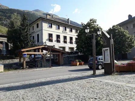
By bus: Line S52 or S53 - Tourist Office stop.
By car: park near the Lanslebourg Tourist Office; electric vehicle recharging point on the side of the building.
Documents

Animals
Pets allowed : No
Pets are not allowed on this hike in the Vanoise National Park.
Guidebook with maps/step-by-step
-
To guide you in the field, consult the "step-by-step" directional diagram provided in pdf.


-
Distance
10.7km
-
Daily duration
3:30 a.m.
-
Elevation gain
770m
-
Negative gradient
770m