Back
hike
Back
hike
The Beccia loop on foot
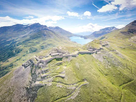
After a stop at Fort de la Turra, venture out on a loop steeped in history. Treat yourself to a day of astonishing discoveries, in return for some demanding exercise. To make sure your excursion's a success, allow plenty of time and check that the weather forecast is entirely favourable.
Description
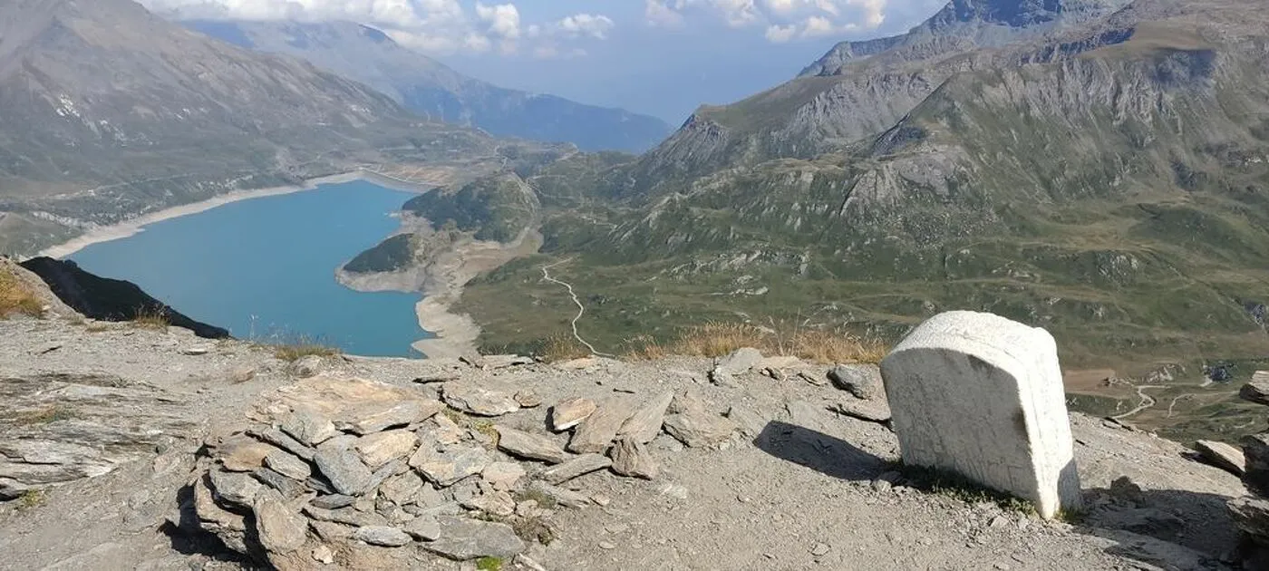
In the first ascent up to La Turra Fort, the sections with handrails will require your attention. But these challenges are short-lived. Climb without hesitation! After a relaxing break at the fortress, enter lunar landscapes. Welcome to the rocky paradise of chamois! Can you hear the echo of stones rolling under their hooves? The remains of buildings that once lined the former French-Italian border are strewn along the trail. From its 2,700 m of altitude, Pas de la Beccia offers you an astonishing view of Mont Cenis lake. After a challenging descent that'll test your hiking boots, make your way to the lush meadows and Great Yellow Gentian flowers in full bloom. Recover your sense of tranquillity among the herds grazing on the gentle slopes. Marmots, well hidden in the tall grass, scurry away as you pass. Make a stop at La Vachère farm for some delicious food that'll wipe away the monotony of the last mile. To recharge your energy, you might even have the chance to savour milk freshly drawn from the latest milking.
Additional welcome
The duration of hiking trails is calculated using reference paces: 300 m/h ascent, 500 m/h descent and 4 km/h on the flat.
As hazards may occur at any time on the routes, the GPX tracks provided are not contractual. They are given for information only. Riders use them at their own risk, depending on their level of technological proficiency and their understanding of the terrain.
-
Minimum age: 12
Environments
-
 Waterside
-
Lakeside or by stretch of water
-
Lake view
-
Mountain view
-
Mountain location
-
Panoramic view
-
Presence of livestock and guard dogs
Rates
Free access.
Itinerary
-
 Distance
11.4km
Distance
11.4km
-
 Route type
LOOP
Route type
LOOP
-
 Elevation gain
800m
Elevation gain
800m
-
 Negative gradient
800m
Negative gradient
800m
-
 Daily duration
5:00 a.m.
Daily duration
5:00 a.m.
-
 Signposted itinerary
Yes
Signposted itinerary
Yes
-
 Beaconing accuracy
Mixed markings (PR: yellow blades and GR: white and red)
Beaconing accuracy
Mixed markings (PR: yellow blades and GR: white and red)
-
 Nature of the land
Rock,
Stone,
Grit,
Not suitable for strollers
Nature of the land
Rock,
Stone,
Grit,
Not suitable for strollers
-
 Maximum altitude
2717m
Maximum altitude
2717m
Opening period
From 15/05 to 15/10 daily.
Subject to favorable snow and weather conditions.
Additional opening
-
Subject to favorable weather
-
Subject to snow conditions
Labels
- Listed on the PDIPR
Location
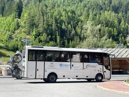
By bus: Line 5 – Col du Mont-Cenis stop (vehicle equipped with a 5-bike rack).
By car: Park in the parking lot at the Col du Mont-Cenis.
Documents

Animals
Pets allowed : Yes
Pets allowed with supplement : No
Pets allowed on leash only.
Guidebook with maps/step-by-step
-
To guide you in the field, consult the "step-by-step" directional diagram provided in pdf.


-
Distance
11.4km
-
Daily duration
5:00 a.m.
-
Elevation gain
800m
-
Negative gradient
800m