Back
hike
Back
hike
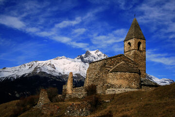
Archettes walking itinerary
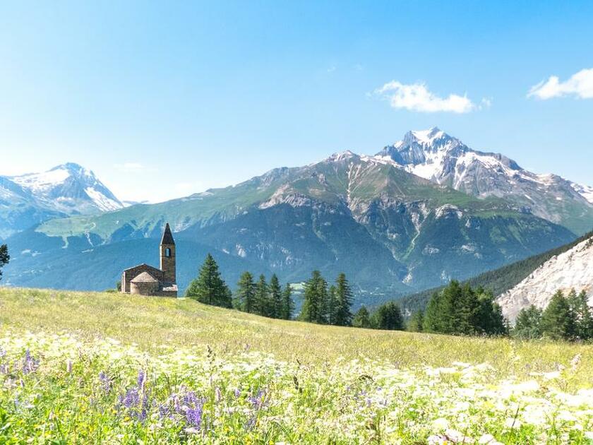
After this out-and-back escape, rich in altitude differences, the mountain range will hold no more secrets for you. From the torrent d'Ambin to the Col de Sollières, discover a varied and rejuvenating world.
Description
Are you ready to traverse a forest suspended above the Val d'Ambin? Starting from Le Cernay, the warm-up is short as far as La Villette. The ubac route then seems a little steep for the first hour, but there are plenty of cool breaks along the Laméranche stream.
The combe des Archettes suddenly welcomes you, opening up onto a grazed clearing. The patous keep a watchful eye on their herd. Fear not, stay on your well-trodden path. But what are those curious gypsum formations to your left? The ridges of Général Sarret will soon make you forget the 800 m you've already climbed.
Stop off near Lac de l'émeraude and take in the Mont Froid fort. The former military barracks bear witness to a rich military history. The detour was well worth the 360° panorama!
Return to your original route to reach the Petit Mont Cenis plateau. Surrounded by peaks as wild as they are fascinating, enjoy the fresh air at 2639 m altitude.
Soon it's time for a quiet descent, with all those memories in your travel diary.
Additional welcome
The duration of hiking trails is calculated using reference paces: 300 m/h ascent, 500 m/h descent and 4 km/h on the flat.
As hazards may occur at any time on the routes, the GPX tracks provided are not contractual. They are given for information only. Riders use them at their own risk, depending on their level of technological proficiency and their understanding of the terrain.
-
Minimum age: 16
Environments
-
 Mountain view
-
Mountain location
-
Presence of livestock and guard dogs
Rates
Free access.
Itinerary
-
 Distance
15.5km
Distance
15.5km
-
 Route type
Round trip
Route type
Round trip
-
 Elevation gain
1200m
Elevation gain
1200m
-
 Negative gradient
1200m
Negative gradient
1200m
-
 Daily duration
06h00
Daily duration
06h00
-
 Signposted itinerary
Yes
Signposted itinerary
Yes
-
 Beaconing accuracy
Departmental signposting (PR: yellow blades)
Beaconing accuracy
Departmental signposting (PR: yellow blades)
-
 Nature of the land
Rock,
Ground,
Not suitable for strollers
Nature of the land
Rock,
Ground,
Not suitable for strollers
-
 Maximum altitude
2680m
Maximum altitude
2680m
Opening period
From 15/06 to 15/10 daily.
Subject to favorable snow and weather conditions.
Additional opening
-
Subject to favorable weather
-
Subject to snow conditions
Documents

Animals
Pets allowed : Yes
Pets allowed with supplement : No
Dogs on a lead.
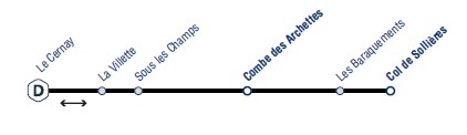
Guidebook with maps/step-by-step
-
To guide you in the field, consult the "step-by-step" directional diagram provided in pdf.


-
Distance
15.5km
-
Daily duration
06h00
-
Elevation gain
1200m
-
Negative gradient
1200m